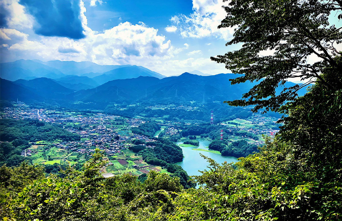
Mt. Takao is a well-known tourist spot, familiar to almost all hikers in the Kanto region.
Although the elevation is only 599 meters, the well-maintained and easy-to-walk trails, the view of Mt. Fuji from the summit, clean restrooms, cable cars, lifts, and even a beer garden provide a comprehensive experience.
Some people might avoid it as a beginner-friendly mountain, but the Oku-Takao traverse route, which extends from Mt. Takao to Mt. Jinba, requires a cumulative elevation gain of over 1,200 meters and covers a distance of about 17.5 kilometers, demanding a decent amount of stamina.
However, the difficulty level is not high, so beginners will be fine as long as they have the necessary stamina.
This time, we introduce a beginner-friendly route from Mt. Takao to Mt. Kagenobu (Kobotoke Bus Stop) with a distance of 10 kilometers and a cumulative elevation gain of about 950 meters.
Route
Takaosan-guchi Station → Mt. Takao Route 6 (Nature Research Trail 6,course time 90 minutes) Mt. Takao summit → Mt. Kobotokeshiroyama → Kobotoke Pass → Mt. Kagenobu → Kobotoke bus stop
From the Kobotoke Bus Stop, there are buses to Takaosan-guchi Station and Takao Station, which will take you back to the starting point.
The duration is approximately 4 hours.
Hazardous spots
There are no particularly hazardous spots, but trail No. 6 has some narrow sections with cases of slips and falls. Also, the steep climb between Kobotoke Pass and Mt. Kagenobu can be slippery when it rains. Neither of these areas has technical difficulties, so there should be no issues as long as you walk cautiously within reasonable limits. Even kindergarten and elementary school children walk these trails.
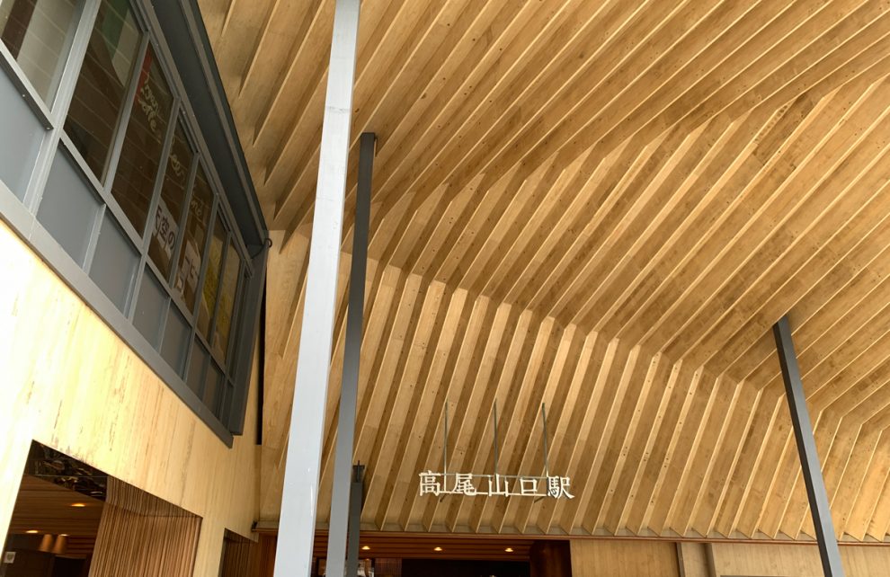
Takaosan-guchi Station
The nearest station to the trailhead is Takaosan-guchi Station on the Keio Takaosan Line. If you are going to Mt. Jimba or traversing the south side of Takao, you would use Takao Station, but for Mt. Takao, use Takaosan-guchi Station.
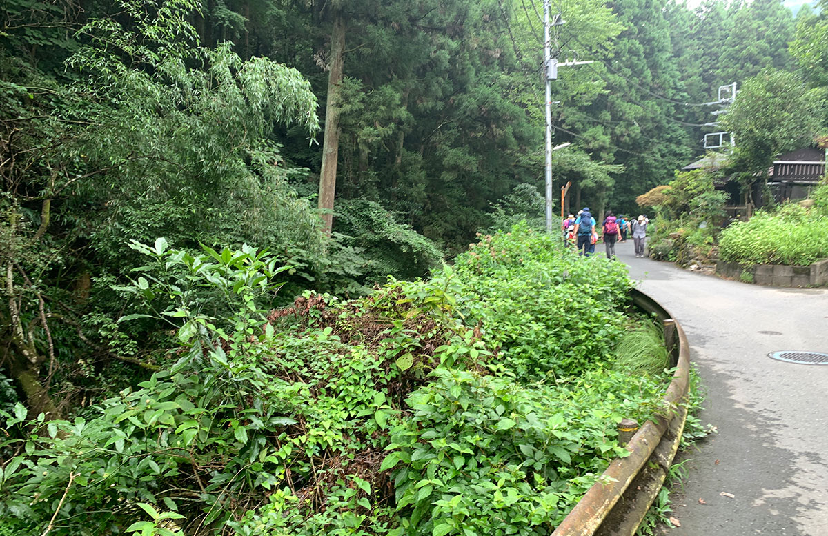
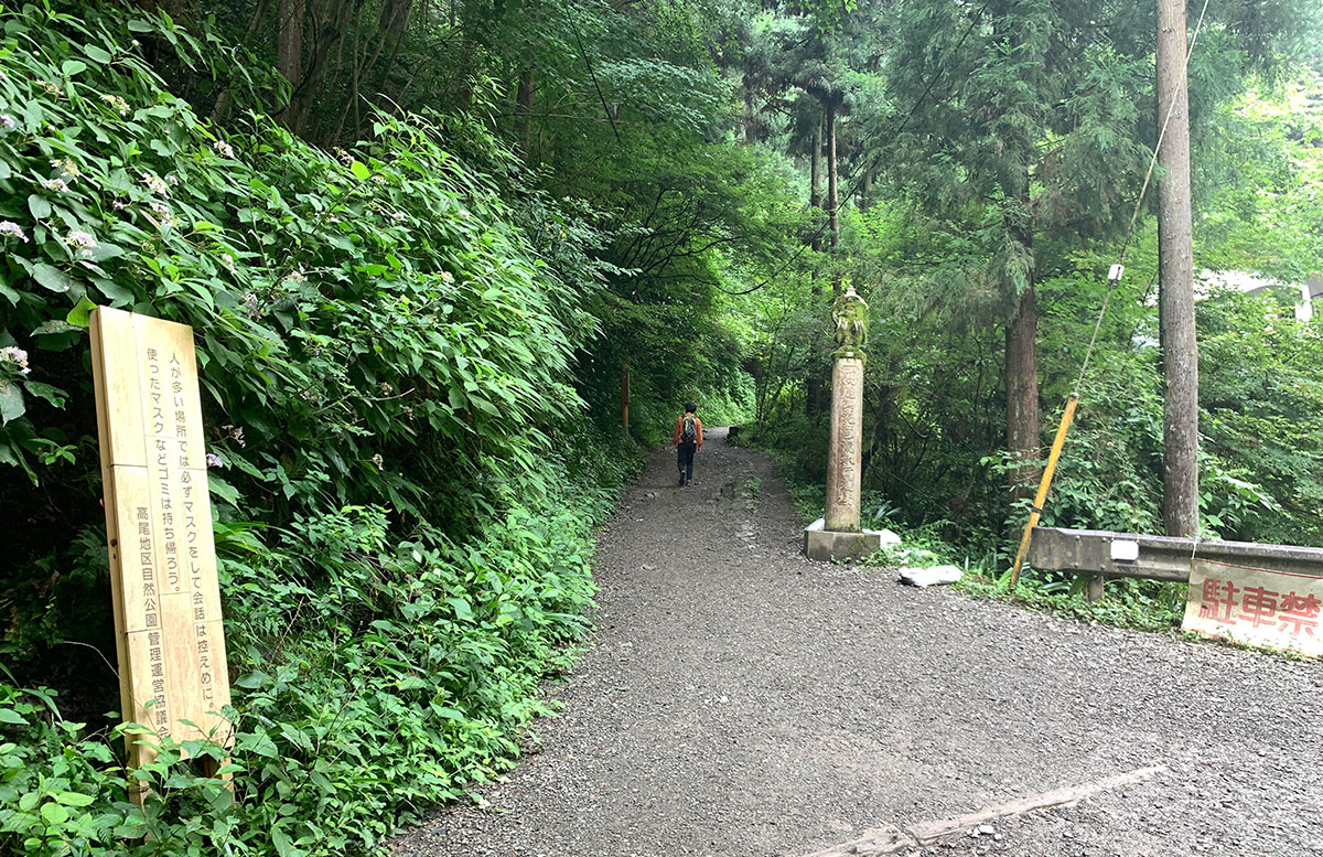
After exiting the station ticket gate, proceed straight to the left.
The path is paved up to the entrance of the trail.
Nature Research Trail 6
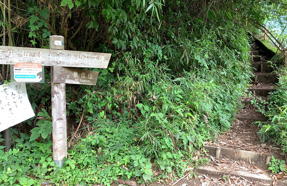
A sign for the entrance to Trail No. 6(Nature Research Trail 6) will appear on your left.
Trail No. 1, which is paved, is often introduced on TV.
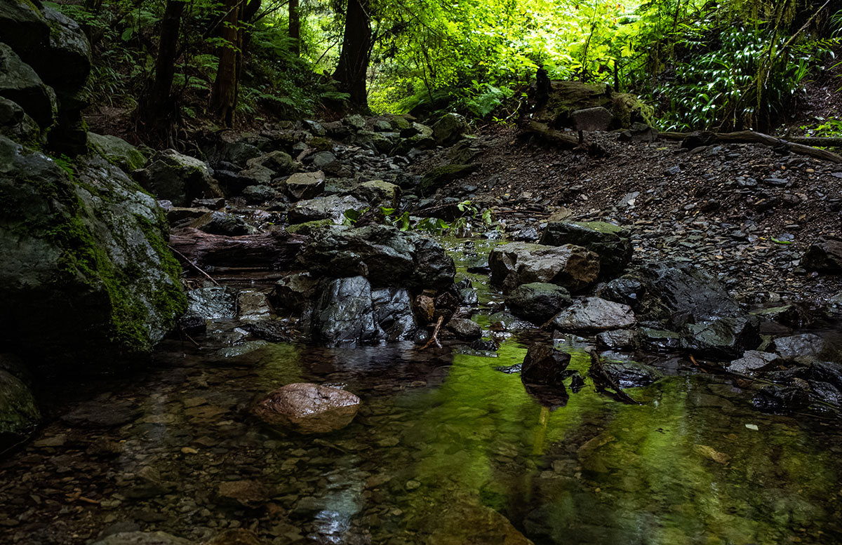
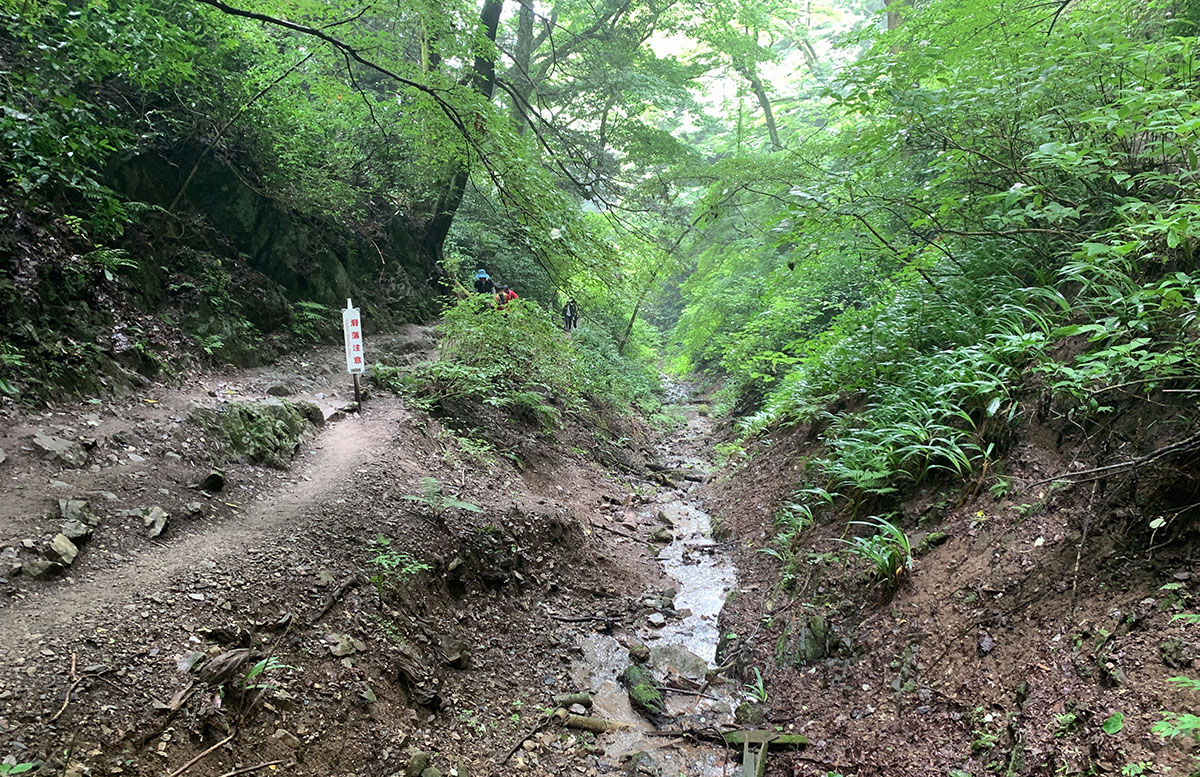
We recommend taking Trail No. 6, which follows a stream, to fully experience the natural atmosphere of the mountain.
Please note that there are no restrooms or shops until you reach the summit.
Also, there are some slippery and uneven spots, so avoid wearing heels or sandals.
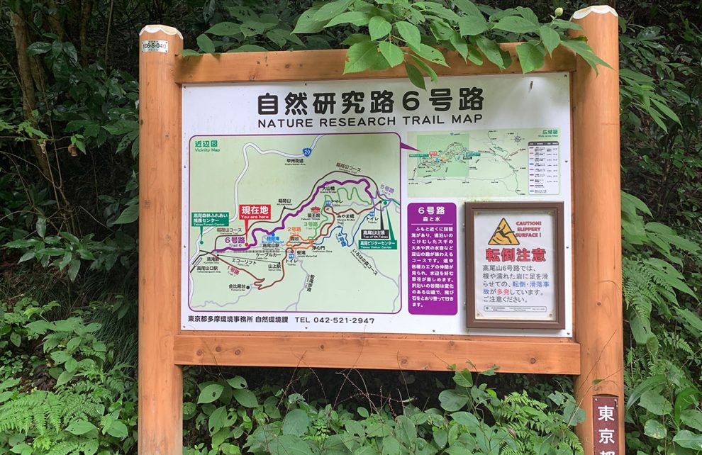
The trail passes by Biwa Falls, which is also a place for waterfall ascetic practices, and is therefore referred to as the Biwa Falls Course.
This is a quiet course with waterfalls and streams.

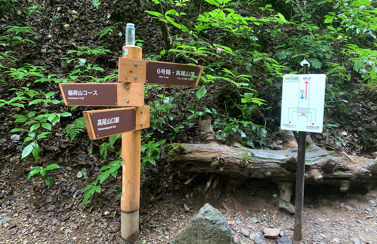
After crossing the third bridge, you will come to the fork leading to the Inariyama Course.
Trail No. 6 continues along the stream, crossing stepping stones.
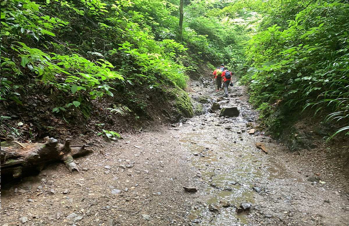
If the water level isn’t too high, you don’t have to force yourself to walk on the stepping stones.
Prioritize safety as the rocks can be slippery.
After passing the stepping stone area, you will encounter a long staircase.
Be careful of the overhanging trees.
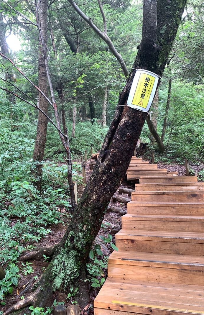
Looking down, you can see the staircase continuing like this.
After crossing the staircase, there is a small rest area.
Catch your breath and keep going; the summit is just around the corner.
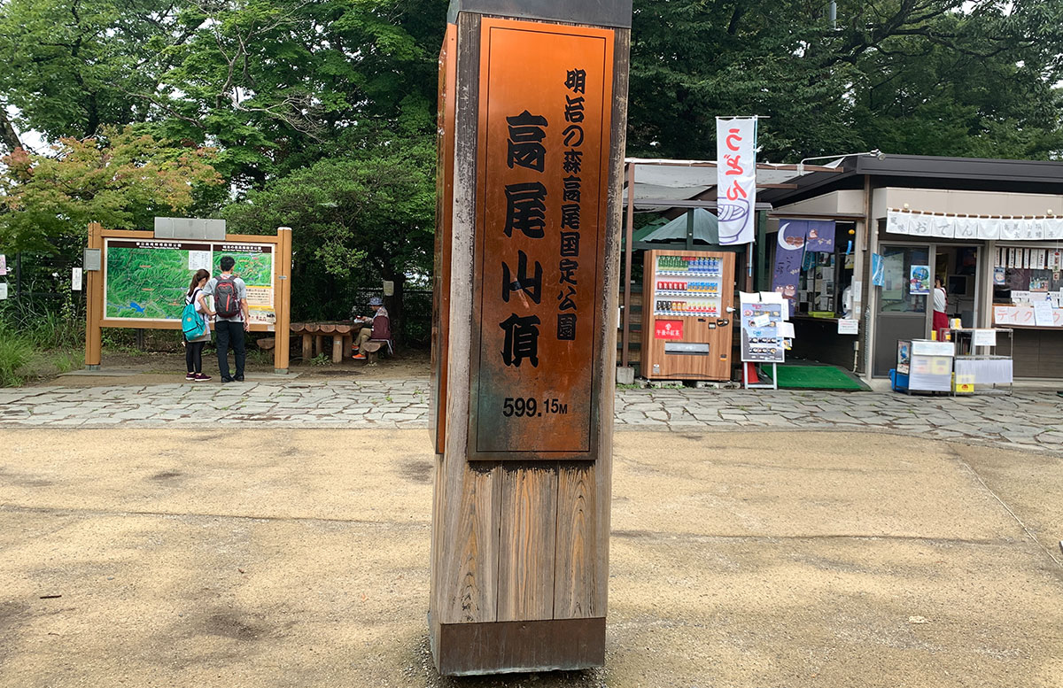
You have reached the summit of Mt. Takao (599m).
The next target point is Mt.Kobotoke-shiroyama.
To Mt. Kobotoke-shiroyama
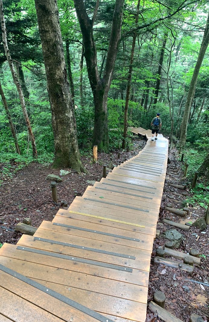
The trail between Mt. Takao and Mt.Kobotoke-Shiroyama consists of gentle ascents and descents.
The path is well-maintained and easier to walk than Trail No. 6, but there are many stairs.
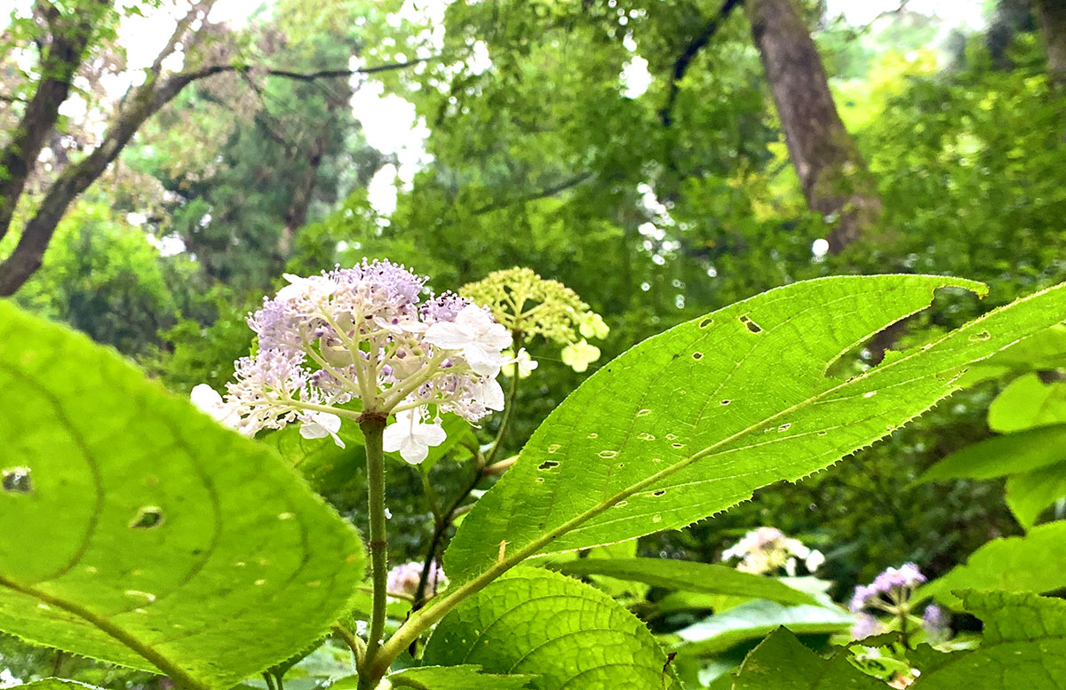
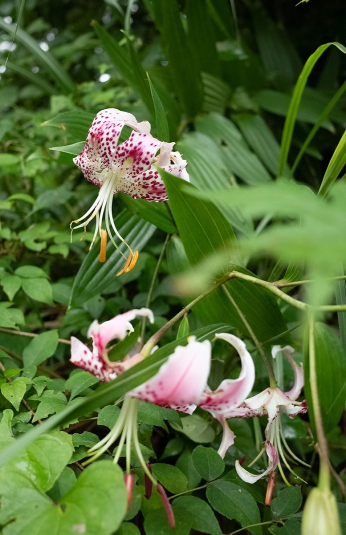
There are also many flowers in bloom.
Icchodaira-Enchi, a resting spot with a restroom, is located past the midpoint.
Climbing the wooden stairs from here will take you to the observation deck of Icchodaira.
And now, you’ve arrived at Mt.Kobotoke-shiroyama.
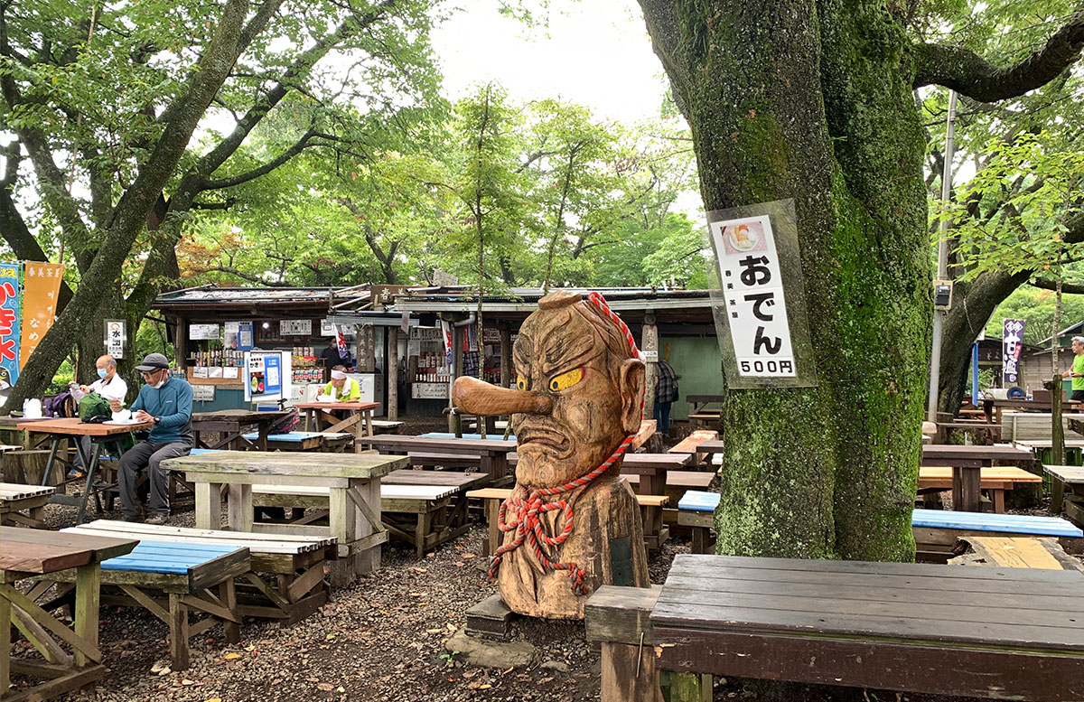
There is a teahouse at the top of Mt. Kobotoke-shiroyama where you can get drinks and other refreshments.
To Kobotoke Pass
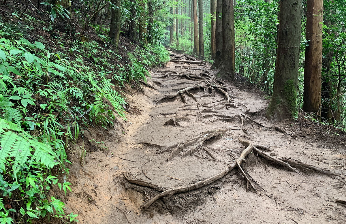
From here, you will descend in elevation towards Kobotoke Pass.
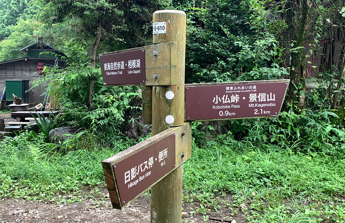
There are some areas with protruding tree roots, but the trail remains within a manageable range.
Before reaching Kobotoke Pass, there is a spot where you can see Lake Sagami.

Descending a steep staircase from this point will take you to Kobotoke Pass.
Kobotoke Pass is a road that was developed as part of the Koshu Highway during the Edo shogunate.
In Meiji 13 (1880), Emperor Meiji took a break at the teahouse in Kobotoke Pass while traveling in a palanquin during his Koshu tour, and a monument was erected to commemorate this event (Emperor Meiji’s Kobotoke Pass Resting and Standing Area).
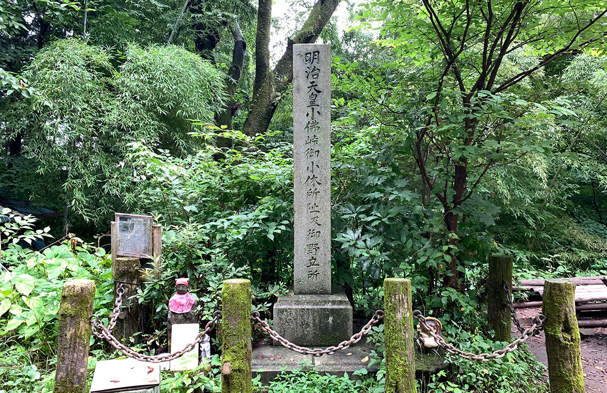
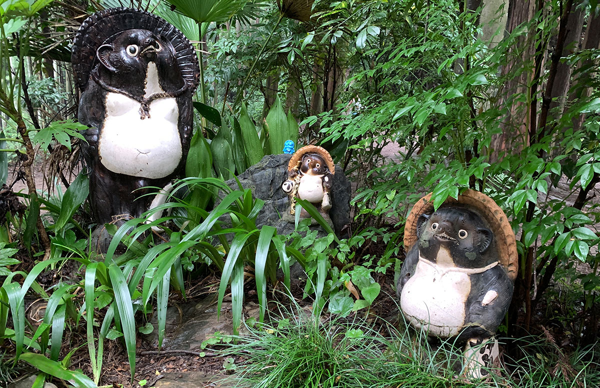
There is also a raccoon dog figurine for some reason.
To Mt.Kagenobu
The distance from Kobotoke Pass to Mt. Kagenobu is 1.2 kilometers, and the trail features slippery, steep ascents.
Be especially cautious after rain.
Once you have conquered the steep climb, you will arrive at the summit of Mt. Kagenobu (727m). First, you will see a teahouse, with another one located farther back.
The summit marker is near the second teahouse.
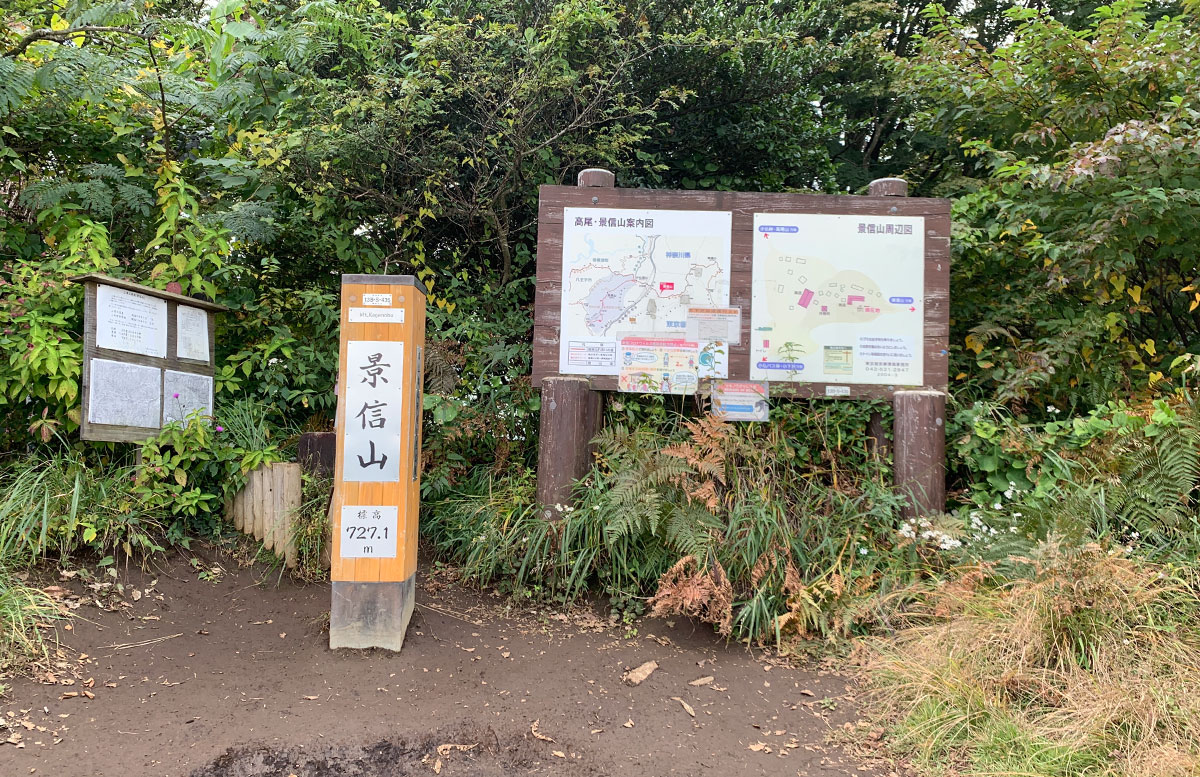
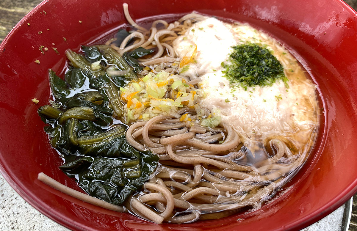
You can also enjoy tororo soba noodles here.
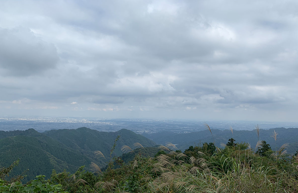
Although it is cloudy today, the view is great, and the area is quite open when it’s sunny.
Now, let’s descend to the Kobotoke Bus Stop.
To the right of the teahouse, near the restroom, is the route leading to the Kobotoke Bus Stop.
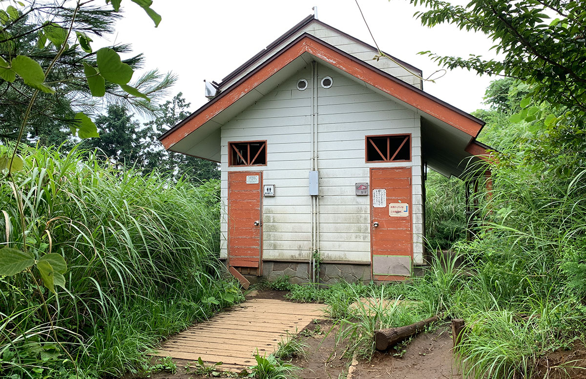
With the restroom on your right, start your descent.
The descent itself takes about 40 minutes.
There is a fork in the trail along the way.
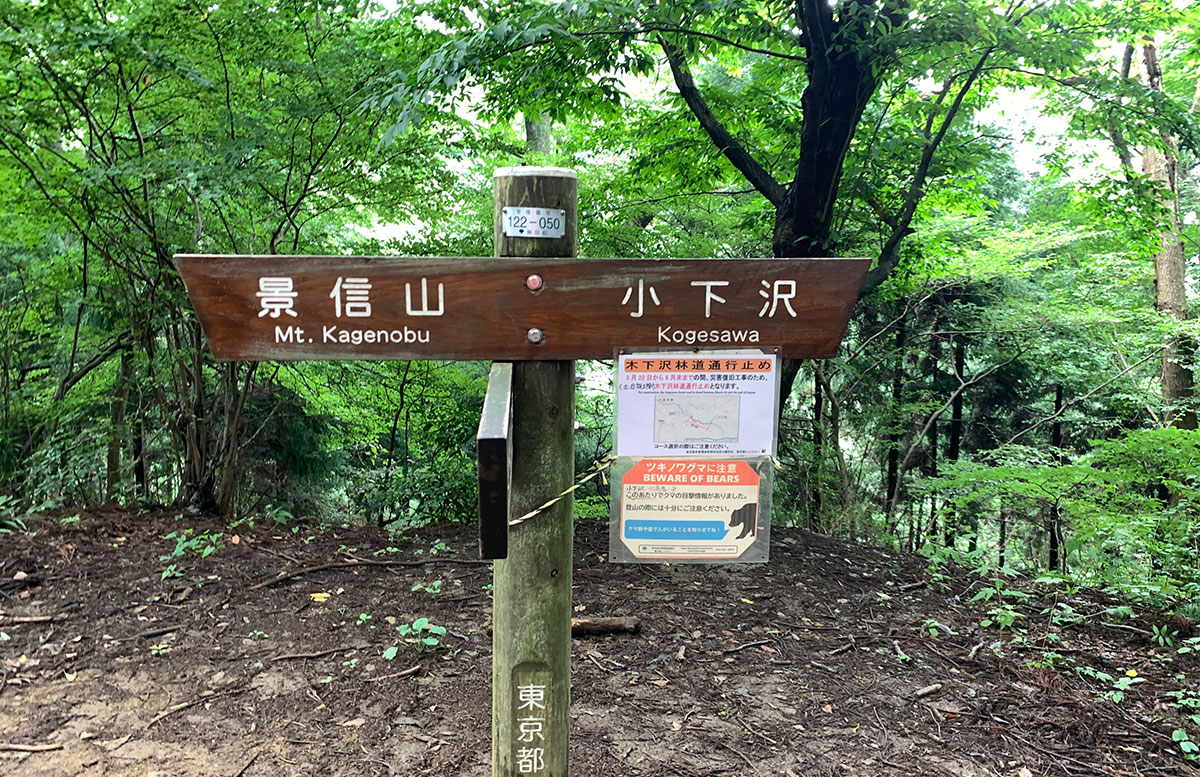
The Kogesawa direction is closed as of August 2022.
Please be cautious as there have been bear sightings in the area.
From here, the trail becomes steep for a while.
Looking back, you can see how steep it is.
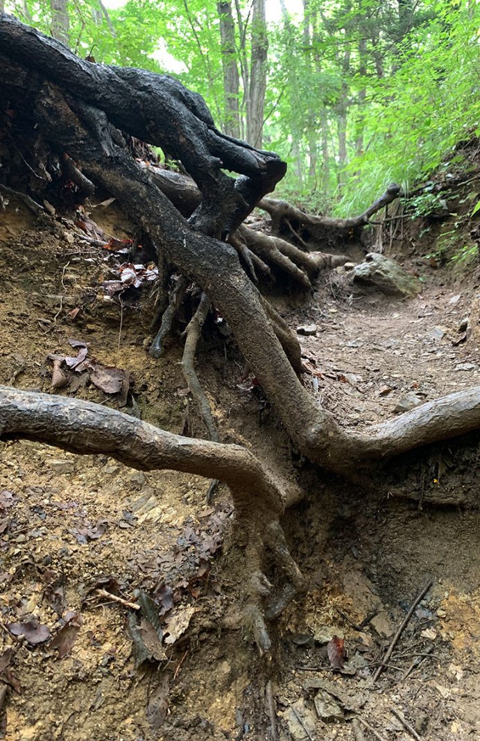
Although it is slippery, walking carefully one step at a time should not pose any problems.
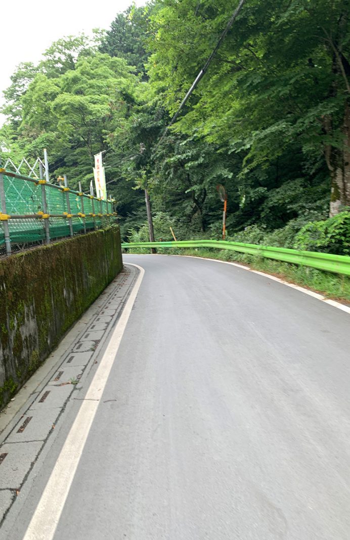
You have now reached the trailhead.
Turn left and follow the paved road downhill.
Walking straight downhill, you will see the Kobotoke Bus Stop on your left in about 7-8 minutes.
This is also a bus turnaround point, so the area is spacious, with restrooms and a place to wash your shoes.
Congratulations, you’ve reached the goal!